
Animations
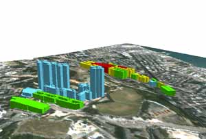 |
Ho Man Tin Urban Heat Island Model (Overlaid with IKONOS image)*
This Virtual Reality model shows the Urban Heat Island effect in Ho Man Tin, Kowloon. |
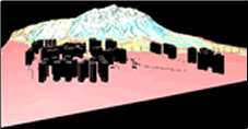 |
Landslide susceptibility (with Tuen Mun Virtual City)*
This Virtual Reality model demonstrates landslide susceptibility regions adjacent to Tuen Mun Town, New Territories |
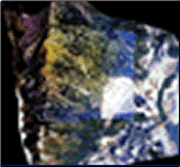 |
Landslide in Tuen Mun (Overlaid with Landsat and aerial photo)
This Virtual Reality model shows the landscape of Castle Peak, New Territories, by overlaying 2001 air photos and Landsat image onto a DEM |
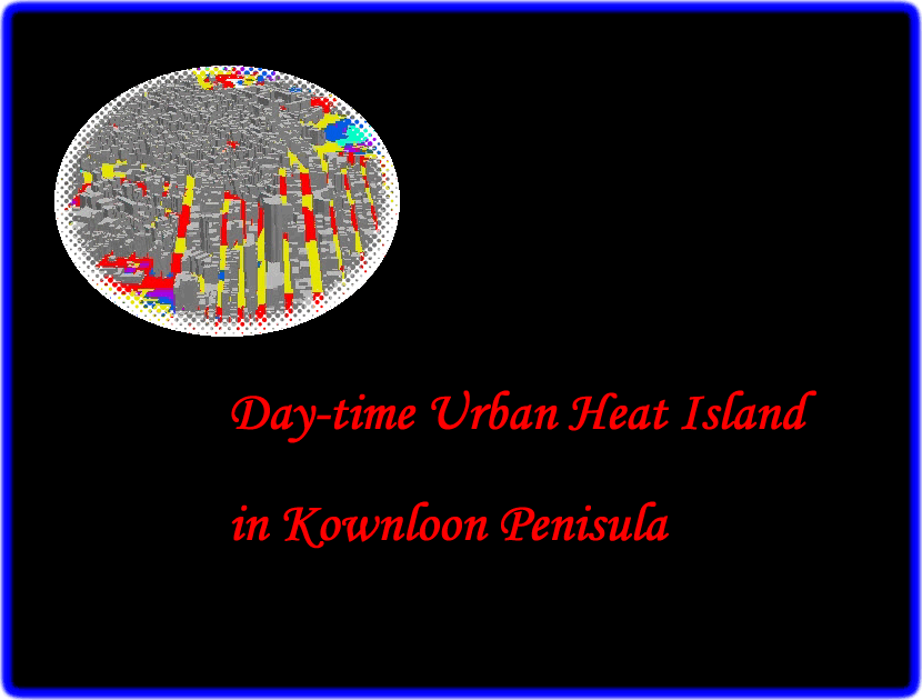 |
Winter Daytime Urban Heat Island in Kowloon Penisula
The animation shows the daytime UHI in Kownloon Penisula. |
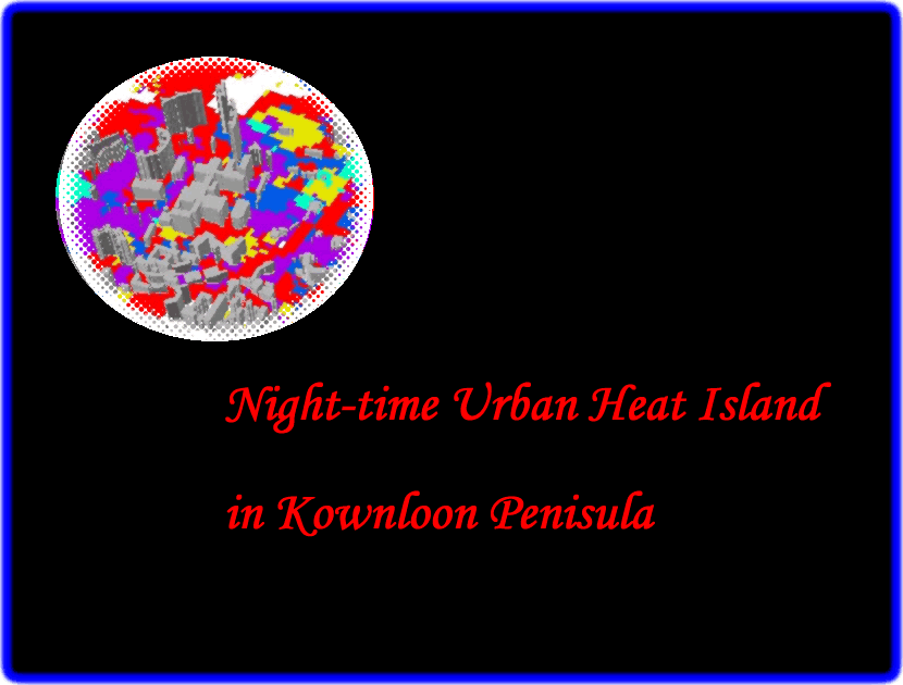 |
Winter Nighttime Urban Heat Island in Kowloon Penisula
The animation shows the nighttime UHI in Kownloon Penisula. |
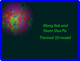 |
Mong Kok and Sham Shui Po Thermal 3D Model
The poor urban design creates direct solar illumination of buildings. Very high surface temperatures on some concrete facets were found in the model. |
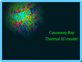 |
Causeway Bay Thermal 3D Model
The temperature of each building facet is calculated and modeled in this animation. The modern reflective glass buildings in Causeway Bay have lower surface temperature than the older concrete buildings. |
 |
Castle Peak Landslide Modelling
This animation shows landslides on Castle Peak, Hong Kong, with changes shown on air photos between 1988 and 2001. It also shows a landslide susceptibility map indicating the highest susceptibility zone that is very close to Tuen Mun Town. |
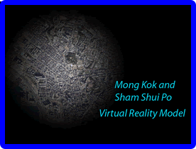 |
Mong Kok and Sham Shui Po Virtual Reality Model
This animation shows MongKok which is the highest populated commerical and residental area in Hong Kong. Most of the buildings are old and of utilitarian design. |
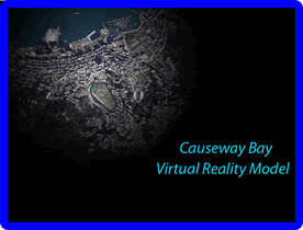 |
Causeway Bay Virtual Reality Model
This animation shows the high rise district of Causeway Bay, in Hong Kong. The narrow street corridors/canyons and some transverse buildings block the flow of fresh air into the district. |
Note
* VCML plugin such as CosmoPlayer or Cortona is required to play these Virtual Reality (VR) models.