


- Research Area
- Research Directions
- Research Outcomes
- Awards & Achievements
- Laboratories
- Cadastre Survey Laboratory
- Digital Cartography Laboratory
- Laboratory for Geographic Information Systems
- Geomatics Computing Laboratory
- Hydrographic Surveying Laboratory
- Navigation Laboratory
- Photogrammetry and Robotic Vision Laboratory
- Laboratory for Smart City and Spatial Big Data Analytics
- Survey Store and Instrumentation Laboratory
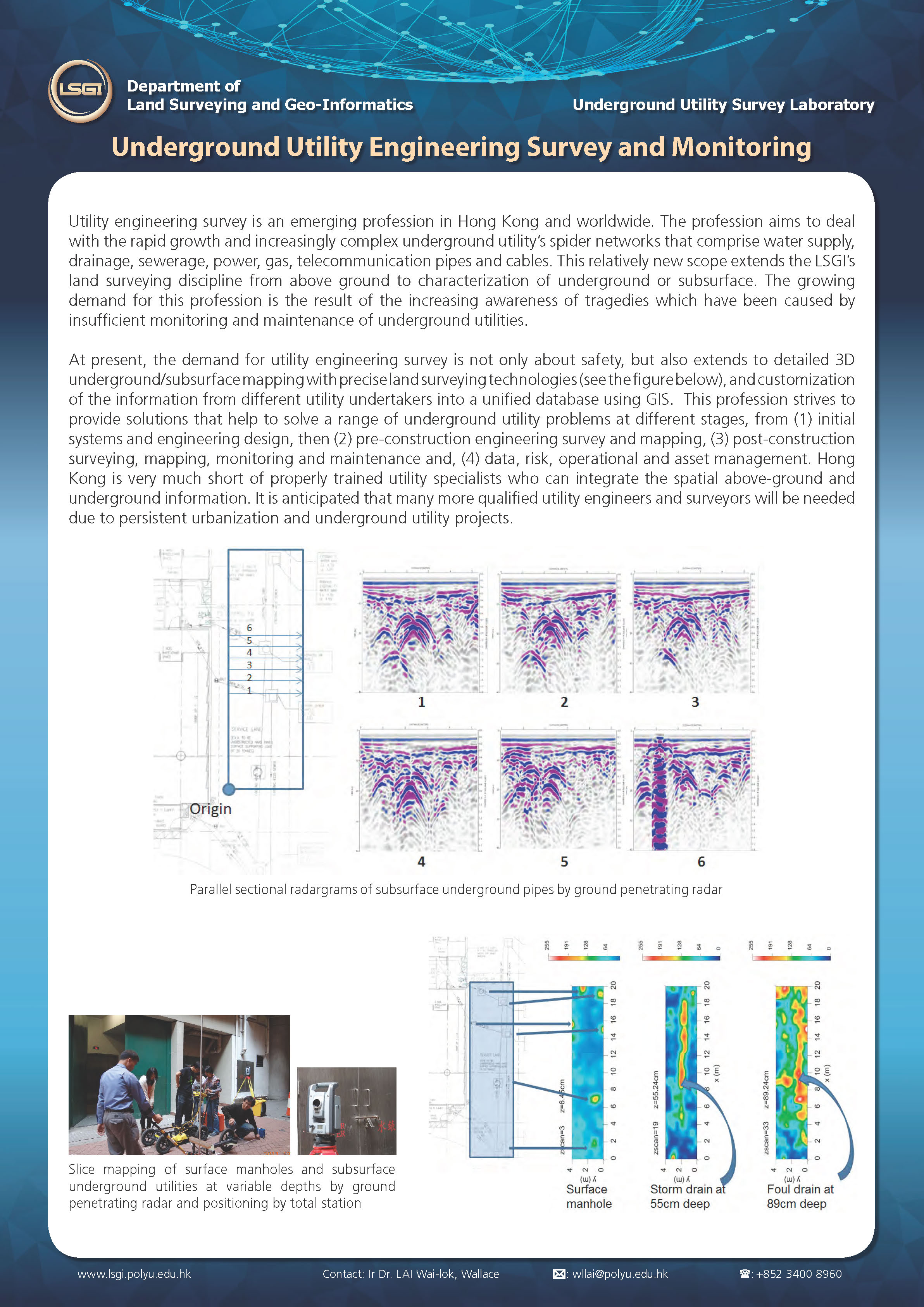
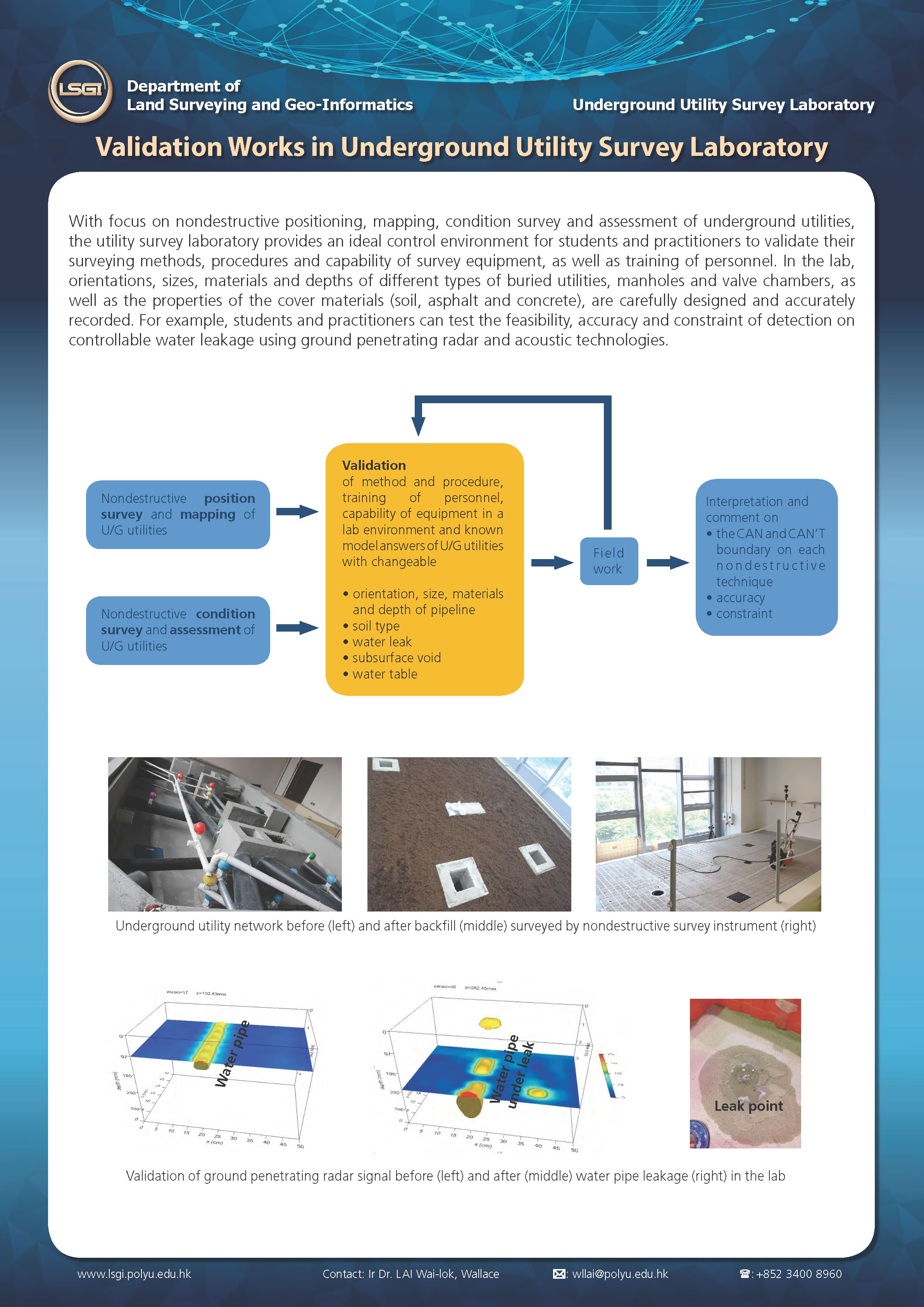
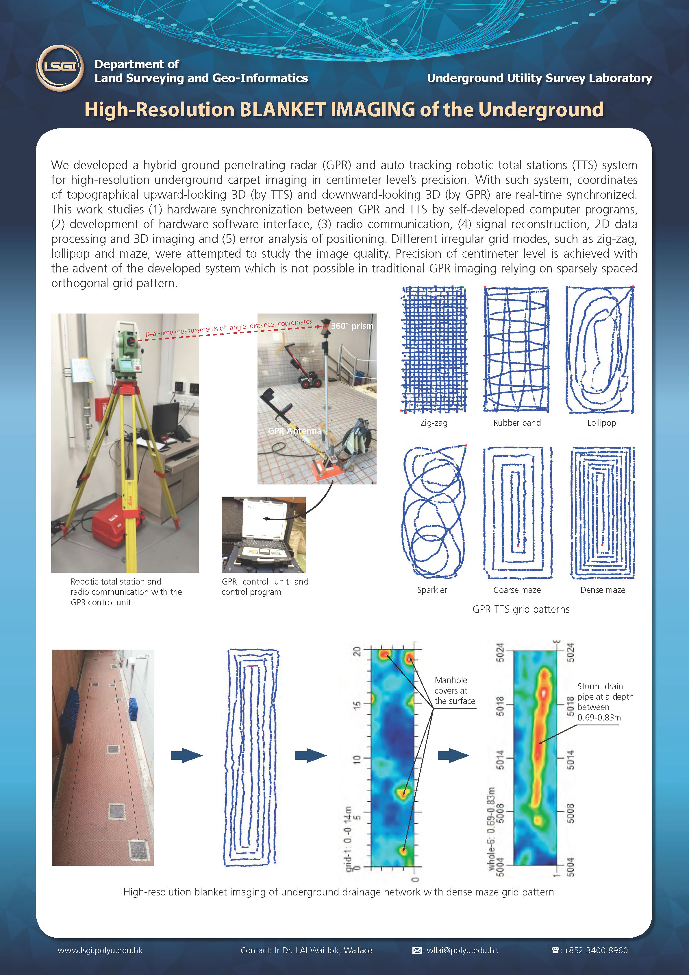
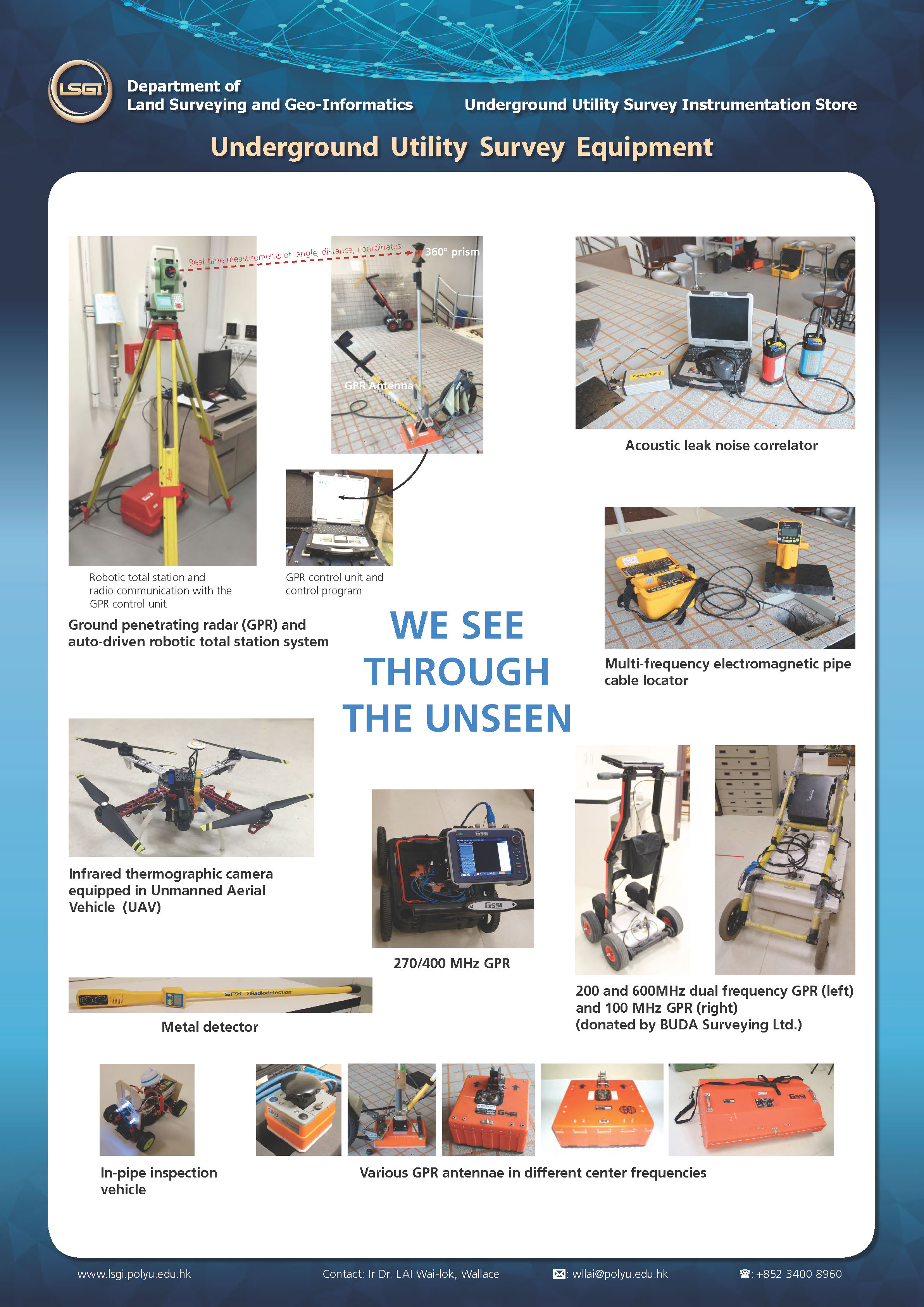
- Underground Utility Survey Laboratory
- Laboratory for Deformation and Geohazards Studies
- Remote Sensing Laboratory
- Research Centres
- Postgraduate Programmes
Underground Utility Survey Laboratory
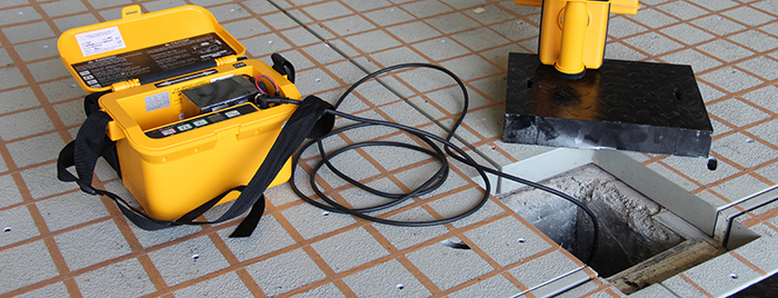
The Underground Utility Survey Lab in LSGI has been in operation since July 2014. Lab occupies a floor area of 73.3 m2. Scale-down networks and matrix consisting of metallic & non-metallic fresh & salt water supply pipes, drainage & sewerage pipes connected with manholes, power cables and gas cables, and valve chambers of various kinds are embedded in a big tank in the lab. These networks of underground utilities and the back-filled soil serve as a scale-down model comparable to actual field conditions. The lab provides an indoor and controllable environment where orientations, depths, sizes, material types, coordinates of various utilities networks are carefully designed and recorded. All these attributes are geo-referenced and integrated into a geographic information system. The surveys are conducted by a range of utility survey/near-surface geophysical equipment, such as ground penetrating radar, electromagnetic pipe cable locator, acoustic leak noise correlator, infrared thermography, etc.