• +852 2766 4655
  • rsl@polyu.edu.hk
  • Home
  • Projects
    • Augmented Teaching and Learning Advancement System
    • An integrated knowledge-based Remote Sensing and GIS dynamic model for the urban thermal environment
    • A UV-based Remote Sensing Technology For Sulphur Dioxide Detection And Monitoring From Ship Emissions
    • A Practical Application of Integrated Micro-Environmental Monitoring System for Construction Sites
    • Assessing the Impact of Land Use Morphology on Air Pollution and Human Mobility for COVID-19 Incidence
    • Brownfield Classification
    • Coastal Water Quality Monitoring in Hong Kong
    • Characterization of Asian Dust Storms with Geostationary satellites MTSAT
    • Development of AI-based algorithms for classification of tree species and retrieval of tree parameters using handheld laser scanning
    • Development of Hyperspectral Library to Distinguish Urban Tree Species in Hong Kong
    • Environmental adaptability of settlement
    • Estimating Time-series of Anthropogenic Heat Flux at City Scale
    • Establishment of Hong Kong AERONET Station
    • Estimation of solar irradiation on the urban building rooftop in Hong Kong
    • iBeacon Positioning
    • Identification of Rock Outcrops Using Remote Sensing Techniques
    • Impact of The Super Typhoon Manghkut on The Secondary Forest of Hong Kong
    • Jockey Club Smart City Tree Management Project
    • Land Use and Land Cover Mapping of Pearl River Delta region and Hong Kong
    • LiDAR Technique Helps to Acquire Basic Tree Information
    • Machine learning-based estimation of solar potential on three-dimensional urban envelopes
    • MOOC Course: Introduction to Urban Geo-Informatics
    • Modelling Woody Vegetation in Sudano-Sahe-lina Zone of Nigeria Using Remote Sensing
    • Remote Sensing of Forest Succession in Hong Kong's Country Parks
    • Remote Sensing of Secondary Vegetation Succession in Hong Kong's Country Parks
    • Road Defect Detection Using Deep Learning Method
    • Solar Energy Supply in Cloud-prone Areas of Hong Kong
    • Tree Thermal Image
    • 70 Years of Forest Succession in the Degraded Tropical Landscape of Hong Kong
  • People
  • Contact Us

Assessing the Impact of Land Use Morphology on Air Pollution and Human Mobility for COVID-19 Incidence

  • You are here:
  • Home
  • Assessing the Impact of Land Use Morphology...
  • Project Details

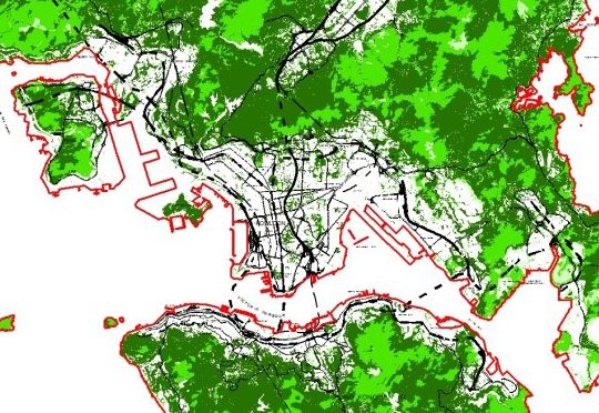
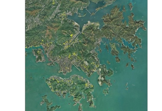
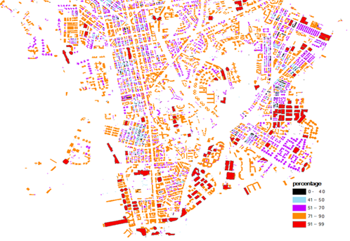
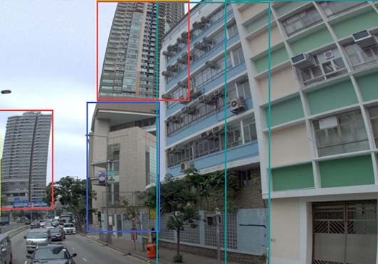
    Land use morphology presents the generalization and interactions of main elements of streets, buildings, and public spaces and precisely depicts physical forms of cities (T. Chen, et al., 2019; Lynch, 1984; Manonmani & Suganya, 2010). Understanding the spatial structures of land use morphology is important in designing urban-rural environments, managing natural resources, and detecting rapid urbanisation (Anderson, 1976; Treitz, Howarth, & Gong, 1992; Wentz, et al., 2006). Representing the socioeconomic characteristics of morphology, the land use represent various human activity-driven functions such as residential, commercial, and public uses (Anderson, 1976; Matsuoka & Kaplan, 2008). The morphology with land use characteristics, namely land use morphology, integrates both environmental and socioeconomic characteristics of regional structures. Understanding these varied spatial structures has compelling significance in supporting city planning and policymaking for assessing the on-going environmental and socioeconomic conditions.

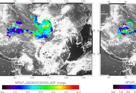
    The rapid emergence of Coronavirus Disease 2019 (COVID-19), caused by severe acute respiratory syndrome coronavirus 2 (SARS-CoV-2), has significantly changed the business-as-usual environmental and socioeconomic conditions. As this new virus is highly contagious and can be transmitted through person-to-person physical contact, countries around the world proposed many policies, including lockdowns and the restricted social distancing measures, to mitigate the spread of the disease (Fisher & Wilder-Smith, 2020; Schlosser, et al., 2020). Research has reported that 90% level of social distancing compliance could control the disease within 13-14 weeks (S. L. Chang, et al., 2020). The restricted social distancing measures have also brought to the varied conditions of individual exposure to air pollution (Giani, et al., 2020; G. He, Pan, & Tanaka, 2020). Evidence has been provided that the lockdowns have caused 60% and 31% decline in nitrogen dioxide (NO2) and fine particulate matter less than 2.5 ug in diameter (PM2.5) and an increase trend in ozone (O3) until 15 May 2020 in 34 countries (Venter, et al., 2020). Considering the unprecedented societal implications, it is essential to investigate the substantial changes of air quality and human activity counterfactual to business-as-usual situations, and further evaluate their potential impact on the spread of COVID-19.


Assessing the Impact of Land Use Morphology on Air Pollution and Human Mobility for COVID-19 Incidence

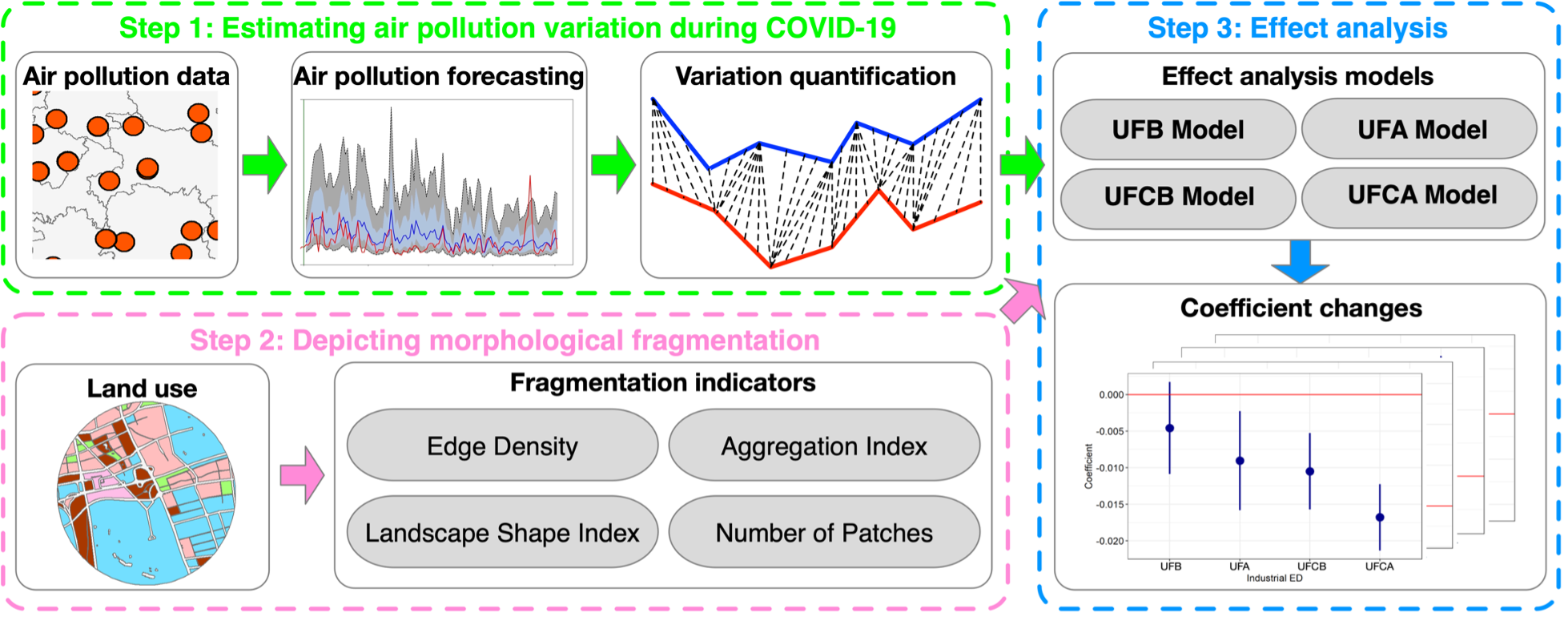
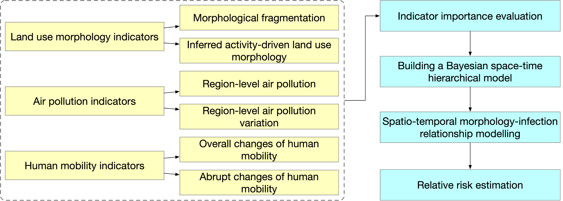
The aim of this study is to assess land use morphology on COVID-19 confirmed cases on a global scale:

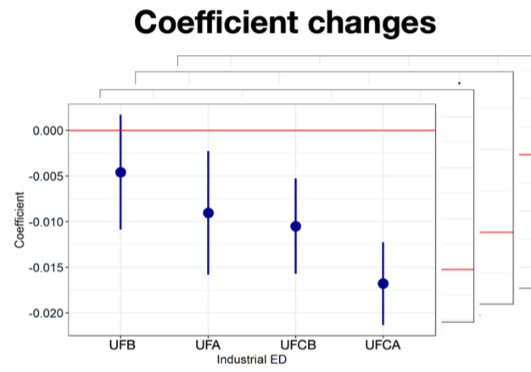
• To investigate and compare the impact of land use morphological characteristics on air pollution variation before and during COVID-19 lockdown

• To quantify the potential mobility capacity from the perspective of land use morphology

• To explore the mediated impact of land use morphology on the interactions between air pollution/human mobility and COVID-19 incidence


Other Research Projects

  • Augmented Teaching and Learning Advancement System
     
    Jockey Club Smart City Tree Management Project
     
    Identification of Rock Outcrops Using Remote Sensing Techniques
    Remote Sensing of Secondary Vegetation Succession in Hong Kong's Country Parks
  • Estimating Time-series of Anthropogenic Heat Flux at City Scale
    Characterization of Asian Dust Storms with Geostationary Satellites MTSAT
    iBeacon Positioning
     
     
    Land Use and Land Cover Mapping of Pearl River Delta region and Hong Kong
  • MOOC course: Introduction to Urban Geo-Informatics
     
     
    A UV-based Remote Sensing Technology For Sulphur Dioxide Detection And Monitoring From Ship Emissions
    Coastal Water Quality Monitoring in Hong Kong
     
     
    A Practical Application of Integrated Micro-Environmental Monitoring System for Construction Sites
  • 70 Years of Forest Succession in the Degraded Tropical Landscape of Hong Kong
    Impact of The Super Typhoon Manghkut on The Secondary Forest of Hong Kong
    Development of Hyperspectral Library to Distinguish Urban Tree Species in Hong Kong
    Remote Sensing of Forest Succession in Hong Kong's Country Parks
  • Modelling Woody Vegetation in Sudano-Sahe-lina Zone of Nigeria Using Remote Sensing
    LiDAR Technique Helps to Acquire Basic Tree Information
     
    Road Defect Detection Using Deep Learning Method
     
    Tree Thermal Image
     
     
  • Solar Energy Supply in Cloud-prone Areas of Hong Kong
     
     
    Brownfield Classification
     
    Establishment of Hong Kong AERONET Station
     
    Environmental adaptability of settlement
     
  • Assessing the Impact of Land Use Morphology on Air Pollution and Human Mobility for COVID-19 Incidence
     
    Development of AI-based algorithms for classification of tree species and retrieval of tree parameters using handheld laser scanning

     Estimation of solar irradiation on the urban building rooftop in Hong Kong
     
     
    An integrated knowledge-based Remote Sensing and GIS dynamic model for the urban thermal environment
     
  • Machine learning-based estimation of solar potential on three-dimensional urban envelopes
  • Prev
  • Next

Copyright © 2018 - 2022.Remote Sensing Laboratory, The Hong Kong Polytechnic University. All rights reserved.

  •