-
Project Details
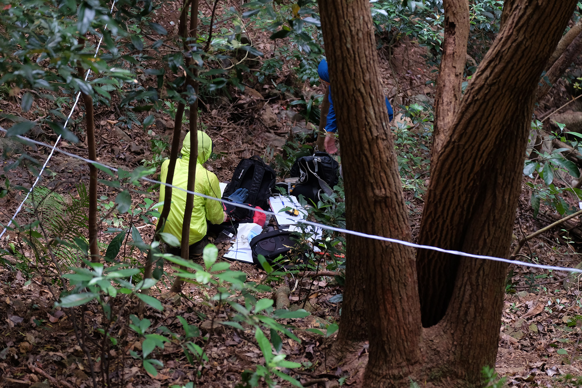
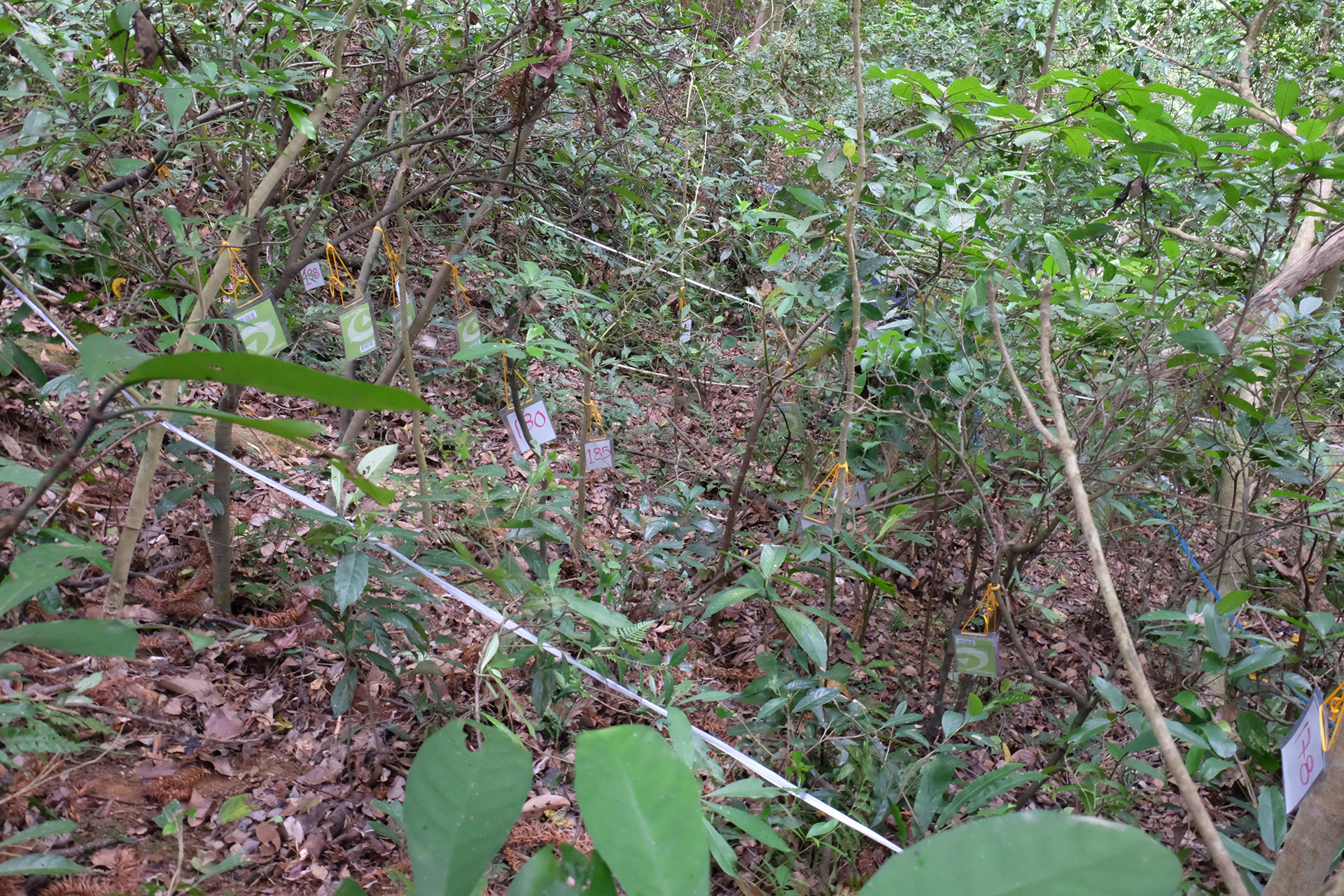
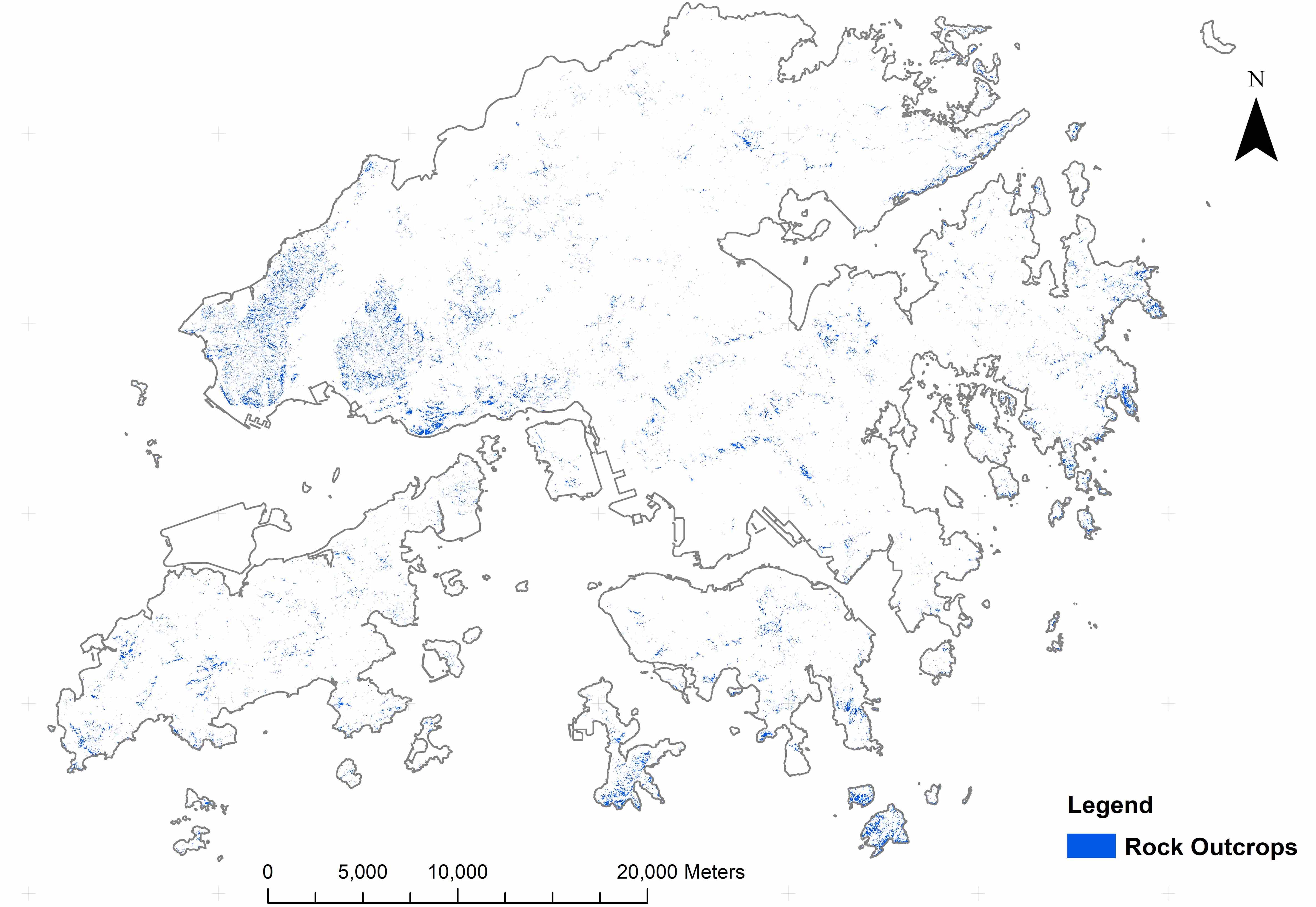
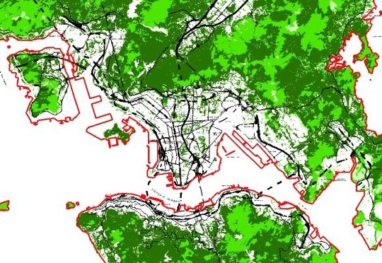
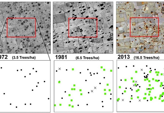
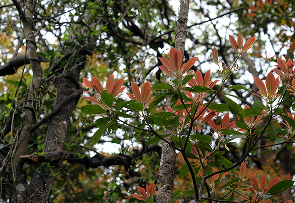
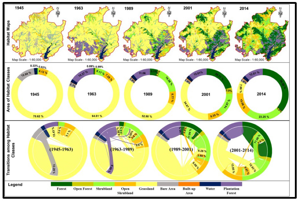
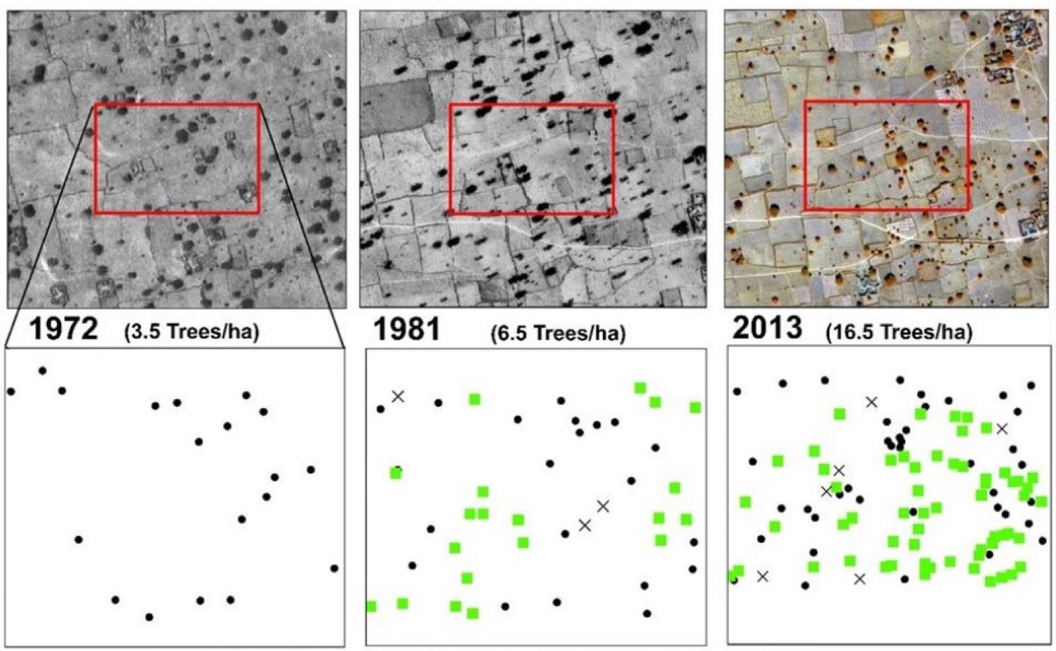
A multi-scale object-based approach was applied to sequential aerial photographs and recent high-resolution satellite images to map structural changes in natural vegetation over the last 70 years, from 1945 to 2014. Temporal changes in the spatial extents of structural classes, and rates of change were determined for each of the periods; from 1945 to 1963, 1963 to 1989, 1989 to 2001, and 2001 to 2014. Also, spatial patterns of forest succession related to topography and morphology of the landscape were analyzed to determine the influence of changes in specific landscape structural parameters on forest succession. The mapping of structural changes associated with forest recovery over the past 70 years also enabled the recording and study of changes in species composition along the successional and environmental gradients for better understanding of the processes of ecosystem recovery in the degraded tropical landscape. This study highlights the roles of GIS and Remote Sensing for effective restoration in locating sites for assisting shrub encroachment, as well as for accelerating secondary succession where shrubland has already been established, and for managing natural succession by planting late successional tree species where the oldest forest pioneers are established.
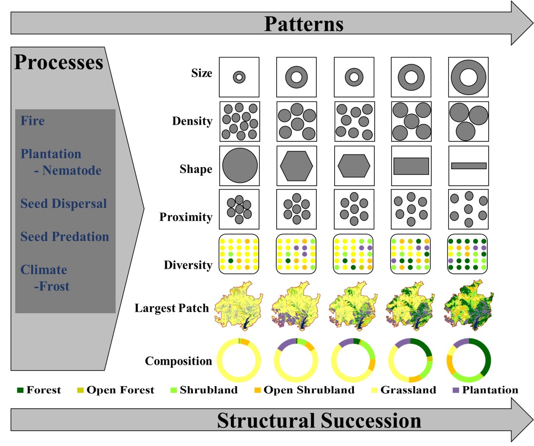
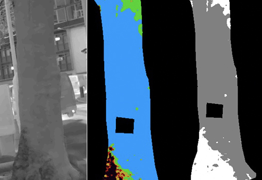
Figure 1: Patterns and processes of structural succession (natural and plantation) of landscape from a grassland dominated to a woodland dominated landscape.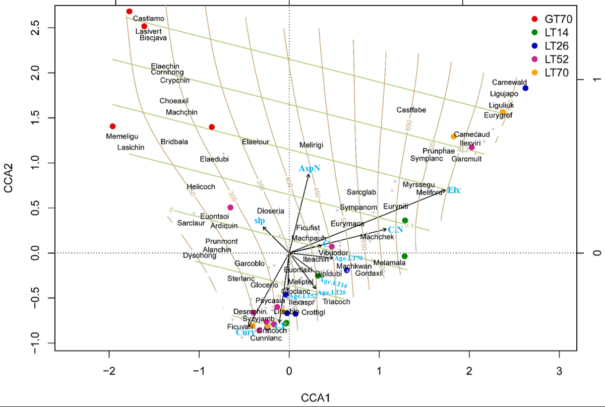
Figure 2: CCA ordination diagram: Showing the relationship of species with the environmental variables ( AspN = northeness (cos of aspect), Slp = slope, Elv = elevation, Curv = Curvature, CI = Convergence Index, C = Soil Carbon, C:N = Carbon and Nitrogen ratio), Geen horizontal lines indicate Aspect surface whereas vertical brown lines indicate elevation surface. Species are shown by “+”sign in grey color overlaid with abbreviated names of dominant species, and S=sites are shown with filled circles of different colors corresponding to age of the site (GT70 = greater than 70-year old forest (forest since 1945), LT70 = less than 70-year old forest (forest since 1963) LT52 = less than 52-year old forest (forest since 1989), LT26 = less than 26-year old forest (forest since 2001), and LT14 = less than 14-year old forest (forest since 2014).
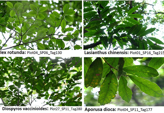
Alanchin = Alangium chinense, Ardiquin = Ardisia quinquegona, Biscjava = Bischofia javanica, Bridbala = Bridelia balansae, Camecaud = Camellia caudata, Camewald = Camellia sinensis var. waldenae, Castfabe = Castanopsis faberi, Castlamo = Castanopsis lamontii, Choeaxil = Choerospondias axillaris, Cornhong = Cornus hongkongensis, Cratcoch = Cratoxylum cochinchinense, Crottigl = Croton tiglium, Crypchin = Cryptocarya chinensis, Cunnlanc = Cunninghamia lanceolata, Desmchin = Desmos chinensis, Dioseria = Diospyros eriantha, Dipldubi = Diplospora dubia, Dysohong = Dysoxylum hongkongense, Elaelour = Elaeagnus loureiroi, Elaechin = Elaeocarpus chinensis, Elaedubi = Elaeocarpus dubius, Euonlaxi = Euonymus laxiflorus, Euontsoi = Euonymus tsoi, Eurygrof = Eurya groffi, Eurymaca = Eurya macartneyi, Euryniti = Eurya nitida, Ficufist = Ficus fistulosa, Ficuvari = Ficus variegata, Garcmult = Garcinia multiflora, Garcoblo = Garcinia oblongifolia, Glocerio = Glochidion eriocarpum, Glocwrig = Glochidion wrightii, Gordaxil = Gordonia axillaris, Helicoch = Helicia cochinchinensis, Ilexaspr = Ilex asprella, Ilexviri = Ilex viridis, Iteachin = Itea chinensis, Lasichin = Lasianthus chinensis, Lasivert = Lasianthus verticillatus, Ligujapo = Ligustrum japonicum, Liguliuk = Ligustrum liukiuense, Litsoblo = Litsea rotundifolia var. oblongifolia, Machchek = Machilus chekiangensis, Machchin = Machilus chinensis, Machkwan = Machilus kwangtungensis, Machpauh = Machilus pauhoi, Melamala = Melastoma malabathricum, Meliptel = Melicope pteleifolia, Meliford = Meliosma fordii, Melirigi = Meliosma rigida, Memeligu = Memecylon ligustrifolium, Myrssegu = Myrsine seguinii, Prunmont = Prunus arborea var. montana, Prunphae = Prunus phaeosticta, Psycasia = Psychotria asiatica, Sarcglab = Sarcandra glabra, Sarclaur = Sarcosperma laurinum, Sterlanc = Sterculia lanceolate, Sympanom = Symplocos anomala, Symplanc = Symplocos lancifolia, Syzyjamb = Syzygium jambos, Triacoch = Triadica cochinchinensis, Vibuodor = Viburnum odoratissimum.
Remote Sensing of Secondary Vegetation Succession in Hong Kong's Country Parks
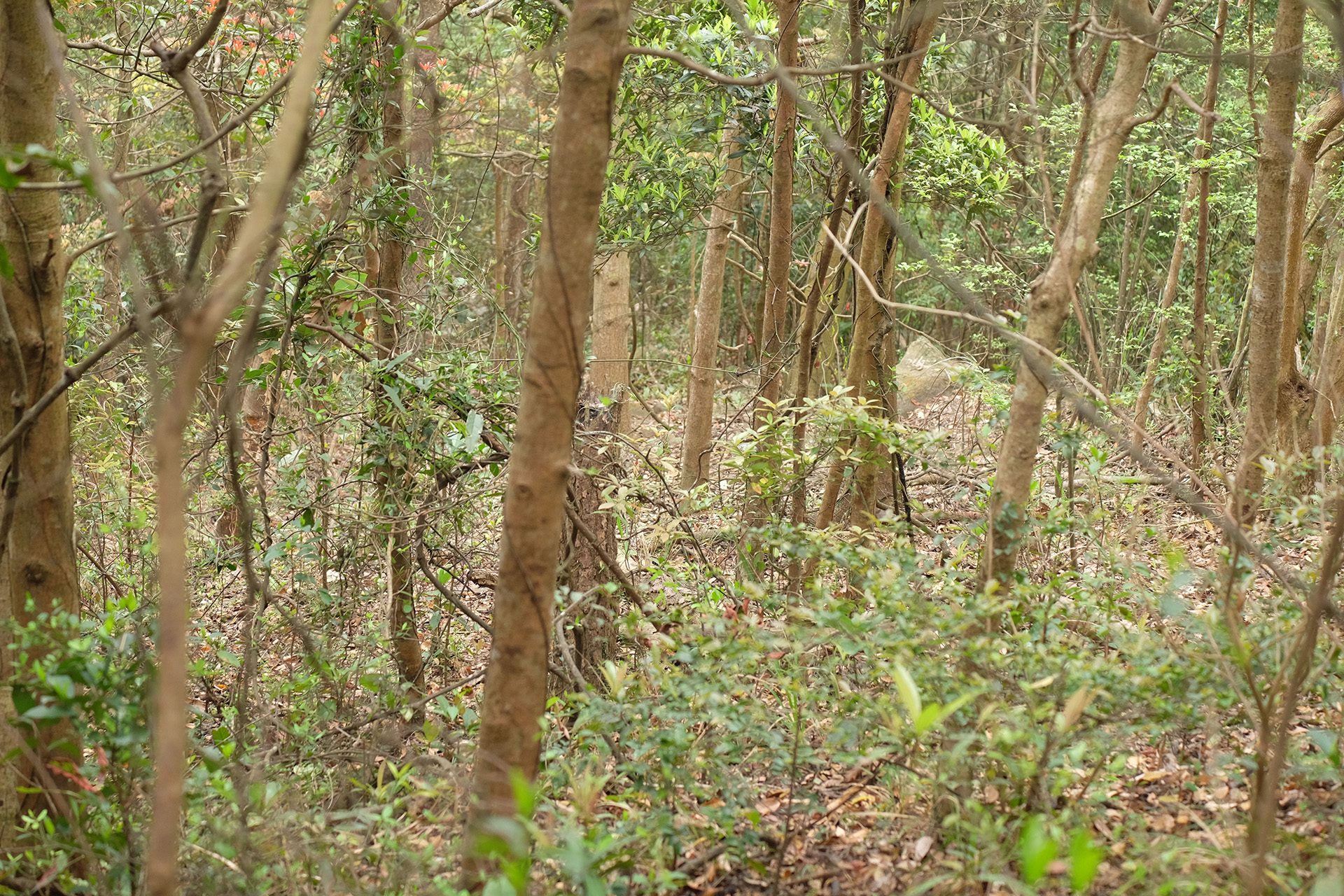
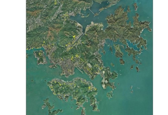
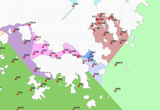
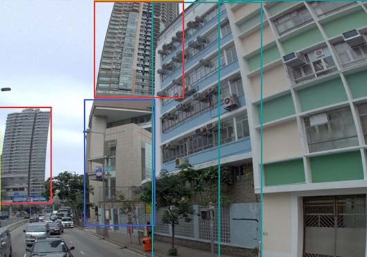
This study aimed to use remotely sensed images to investigate the dynamics of secondary forest succession after a complete clearance of forest in Hong Kong during WWII. The study area (~2800 ha), included Tai Mo Shan and Shing Mun Country Parks in the New Territories of Hong Kong.


