|
Project Overview |
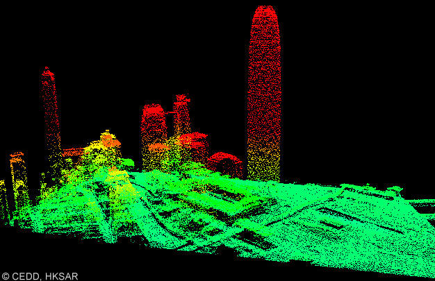
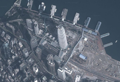
High resolution satellite
(HRS) imagery is an attractive option for surveying and mapping
applications, the advantages being the capacity for high quality
imaging, short revisit time, and lower cost. However, image matching
difficulties have, in the past, caused this option not to be widely
used in the derivation of 3D urban data especially in metropolitan
areas. Automated reliable and dense image matching is essential for
photogrammetric 3D data derivation, however, such matching, in urban
areas, is extremely difficult, owing to the complexity of urban
textures and the severe occlusion problems caused by the impact of
tall buildings on the images. It is of note that most of the
traditional digital photogrammetry systems require intensive human
interaction to process urban area images. This proposal aims at
using HRS imagery for automated 3D point cloud generation in
metropolitan areas by solving key problems such as those mentioned
above.
The newly developed methods
and technologies will enable a cheaper, more automated, image-based
creation of 3D urban data from HRS imagery. These features will
contribute significantly, to urban modelling and mapping
applications. In addition, the up-to-date and easy availability of
HRS imagery will enable the maintenance and updating of 3D urban
models to 4D urban models, hence bringing in element of time change.
This process, currently, has seldom been discussed, because of the
limiting impact of high cost when using other technologies such as
airborne laser scanning. The newly developed innovative image
matching strategy can be applied to other aspects including
terrestrial images and video sequences, hence facilitating automated
image processing for a broad application area in photogrammetry and
computer vision. This proposed research will also advance the use of
high resolution satellite (HRS) imagery for various urban
applications.
|
|
Publications |
-
B. Wu,
Y. Zhang, and Q. Zhu, 2012.
Integrated
Point and Edge Matching on Poor Textural Images Constrained by
Self-Adaptive Triangulations, ISPRS Journal of Photogrammetry and
Remote Sensing, 68(2012):
40 - 55.
-
B. Wu, Y. Zhang, and Q.
Zhu, 2011. A Triangulation-Based Hierarchical Image Matching
Method for Wide-Baseline Images. Photogrammetric Engineering &
Remote Sensing, 77(7): 695-708.
|