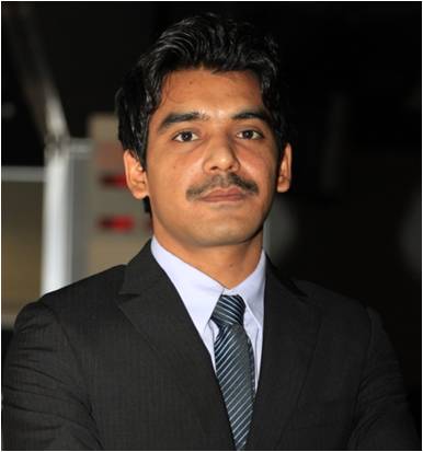
Majid Nazeer
|
I am from Lahore, Pakistan. I received my B.S degree in Space Sciences from University of the Punjab, Lahore, in 2008 and M.S. degree in Meteorology with specialization in remote sensing from COMSATS Institute of Information Technology, Islamabad, in 2010. After completing the masters degree, I served the governmental and non-governmental organizations including, The Urban Unit and WWF-Pakistan for two years as a remote sensing research associate. Later on, I have worked as a lecturer at the Center of Excellence for Climate Change Research, King Abdulaziz University, Jeddah Saudi Arabia. Currently, I am pursuing my PhD in Photogrammetry and Remote Sensing under the supervision of Prof. Janet E. Nichol, at The Department of Land Surveying and Geo-Informatics, The Hong Kong Polytechnic University. My research interest includes the atmospheric correction of the satellite |
imagery, use of optical remote sensing for water quality monitoring and development of algorithms for water constituents retrieval. My awards and honors include, The Hong Kong Polytechnic University International Postgraduate Scholarship for PhD studies and a merit scholarship from COMSATS Institute of Information Technology for masters degree.
|
|
Publications |
|
Laghari, F., Rehman, H.U., Ashraf, I., Gill, K., Nazeer, M., Shahzad, N., Saeed, U. 2011. Pre and post flood GIS based ecological assessment of Kharo Chann, Thatta District. GIS Laboratory, World Wide Fund for Nature (WWF) – Pakistan. Nazeer, M., Jamil, M. 2009. Water Quality Assessment of Rawal Lake Using Satellite Remote Sensing Techniques. Global Conference on Microbial Contaminants in Drinking Water, 5 – 8 October, 2009, Singapore. |
|

