Laboratory for Smart City and Spatial Big Data Analytics
Spatial Data Infrastructure for Smart City
The structure of cities includes many elements, like citizens, activities, and urban spatial objects. Hong Kong, as one of the most well-known international metropolis, has very high complexity in urban morphology, construction environment and transportation system. The Hong Kong SAR Government has addressed six major areas in its Smart City Blueprint, namely Smart Mobility, Smart Living, Smart Environment, Smart People, Smart Government and Smart Economy.
Spatial data infrastructure is a key foundation for smart city development. Our laboratory has launched a spatial data infrastructure platform covering the whole Hong Kong area. Our platform initially integrated outdoor, indoor, above-ground, underground and spatiotemporal dynamic models.
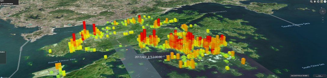
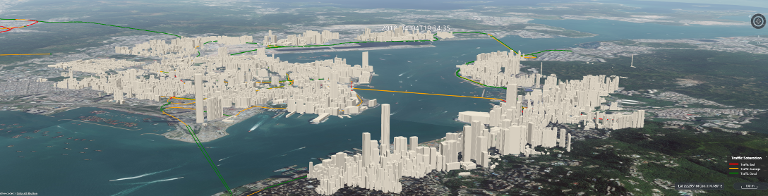
Urban spatial objects and spatial big data visualization platform
Out spatial information infrastructure is based on open-source project Cesium. The core of our platform is the cross-platform and cross-browser WebGL language based on JavaScript, which allows for hardware acceleration for high-performance graphics and visualization. We aim to provide a neutral spatial data platform for potential users or communities with different backgrounds, for extensions into web-based visualizations and applications based on massive 3D geospatial data.
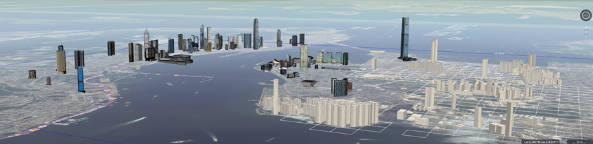
3D Geodatabase
We build our own 3D geodatabase for data storage, sharing, and exchange. 3D GIS needs to deal with various terrains, images, 3D city models and texture data. The data volume in 3D GIS is a few times to even hundreds of times that of 2D GIS. A 3D model for a medium city typically ranges from dozens of GB to hundreds of GB. How to organize and manage such massive data is the core issue of current 3D GIS, and also a key concern for digital earth and digital city technologies.
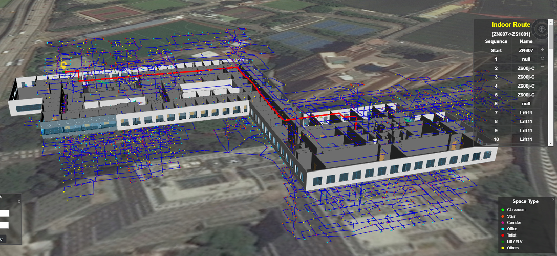
Indoor-outdoor navigation
We are developing an indoor-outdoor seamless navigation solution based on BIM model. Such a solution is essential for densely built cities like Hong Kong and many cities worldwide in future.