Asian Sand/Dust Storm Information (Prediction) |
| Sand/Dust Storm Products |
Explain
Brightness Temperature Difference (BTD) is the most widely use method for dust and sand storm detection. BTD can detect the dust region by calculating the difference between two Infrared bands centered at 11um and 12 um respectively. The physical principle behind is that ice or liquid water particles absorb more infrared radiation at longer wavelength while dust aerosols absorb more at shorter wavelength. Therefore, the dust storm can cause a positive BTD (BT[12um]-BT[11um]), and the higher of the concentration, the bigger of the BTD value.
Three-band Volcanic Ash Product(TVAP) is proposed by Ellrod et al. (2003) to overcome the shortage of BTD in ash detection, especially at night. Different to BTD, TVAP is calculated by three bands centered at 3.75, 11 and 12um. The contribution of the 3.75 band in dust aerosols' detection is primarily form (1) enhance solar reflectance during the daylight hours resulting in large, positive SLIR BTDs, and (2) differential absorption and transmittance at night, resulting in smaller positive BTDs that are still relatively larger than those of cloud and surface features.
legend for BTD and TVAP:
| 1 | 2 | 3 | 4 | 5 | 6 | 7 | 8 | 9 |
|---|---|---|---|---|---|---|---|---|
9: Serious Duststorm
Infrared Difference Dust Index (IDDI) was developed as a satellite dust product designed from midday MeteosatIR imagery, specifically for dust remote sensing in arid regions such as the Sahel and Sahara (Legrand et al., 2001). To take advantage of the impact of dust aerosols on the thermal infrared radiance outgoing to space, IDDI is based on observing thermal radiation (10¨C12¦Ìm) emitted by the same scene over the course of several days, during which time the mineral aerosol content of the atmosphere has changed. The principal assumptions behind this method are (i) the radiance emitted by the surface is constant or linearly varying over the time period of the observa- tions, and (ii) one of the days is dust free. In the presence of dust, the outgoing longwave radiation is attenuated along its path through the dust layer, resulting in a reduction in the outgoing longwave radiation when compared to a clear day. Furthermore, the solar flux available to heat the surface is reduced by the presence of dust aerosols due to enhanced scattering of shortwave radiation, which in turn leads to a drop in the surface temperature. Both of these effects reduce the thermal infrared radiation emitted to space, thereby increasing the contrast between observations obtained during clear and dusty conditions. This thermal contrast can in turn be related to dust loading.
legend for IDDI:| 1 | 2 | 3 | 4 | 5 | 6 | 7 | 8 | 9 |
|---|---|---|---|---|---|---|---|---|
9: Serious Duststorm
Weather, Climate & Duststorm Information
Warnings/Advisories
- Duststorm Warnings/Advisories
- Duststorm Warnings
- Tropical Cyclone Information
Duststorm and Volcanoes
- Duststorm Warnings/Advisories
- Volcanic Information
- Volcanic Ash
Features
 |
MTSAT
imagery on the Sentinel Asia website (links to JAXA Sentinel Asia website) |
|
Numerical
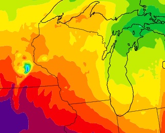
Weather Prediction,WRF-Chem The Weather Research and Forecasting (WRF) Model is a next-generation mesoscale numerical weather prediction system designed to serve both atmospheric research and operational forecasting needs. |
|
NOAA
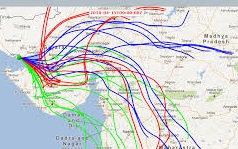
HYSPLIT - Simulating Dust Trajectory The HYSPLIT (HYbrid Single-Particle Lagrangian Integrated Trajectory) model is a complete system for computing simple air parcel trajectories to complex dispersion and deposition simulations. |