
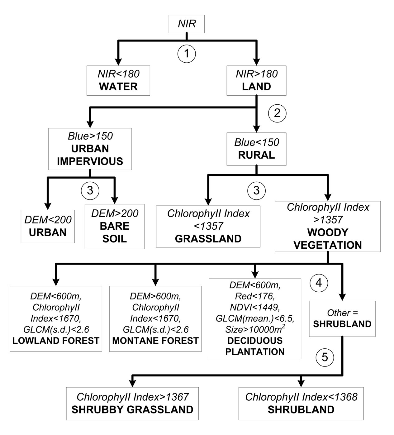
Multi-level Object-oriented Segmentation with Decision Tree Classification (MOOSC) |
Due to the significant time and cost requirements of traditional mapping techniques, accurate and detailed habitat maps for large areas are uncommon. This study investigates the application of IKONOS Very High Resolution (VHR) images to habitat mapping in the rugged terrain of Hong Kong’s country parks. A required mapping scale of 1:10 000, a minimum map object size of 150 m2 on the ground, and a minimum accuracy level of 80 percent were set as the mapping standards. Very high quality aerial photographs and digital topographic maps provided accurate reference data for the image processing and habitat classification. A comparison between manual stereoscopic aerial photographic interpretation and image classification using pixel-based and object-based classifiers was carried out. The Multi-level Object Oriented Segmentation with Decision Tree Classification (MOOSC) was devised during this study using a suite of image processing techniques to integrate spectral, textural, and spatial criteria with ancillary data. Manual mapping from air photos combined with fieldwork obtained the best result, with 95 percent overall accuracy, but both this and the MOOSC method, with 94 percent, easily met the 80 percent specified accuracy standard. The MOOSC method was able to achieve similar accuracy for aerial photographs, but at only one third of the cost. More details can be referred to:
 |
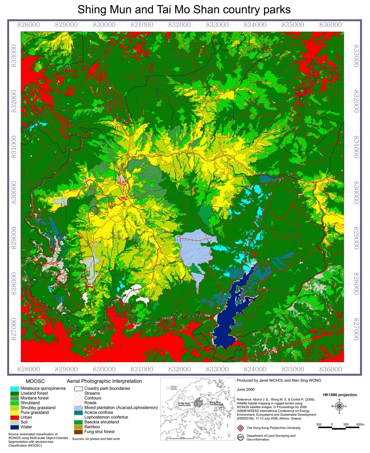
MOOSC image for Tai Mo Shan and Shing Mun country parks |
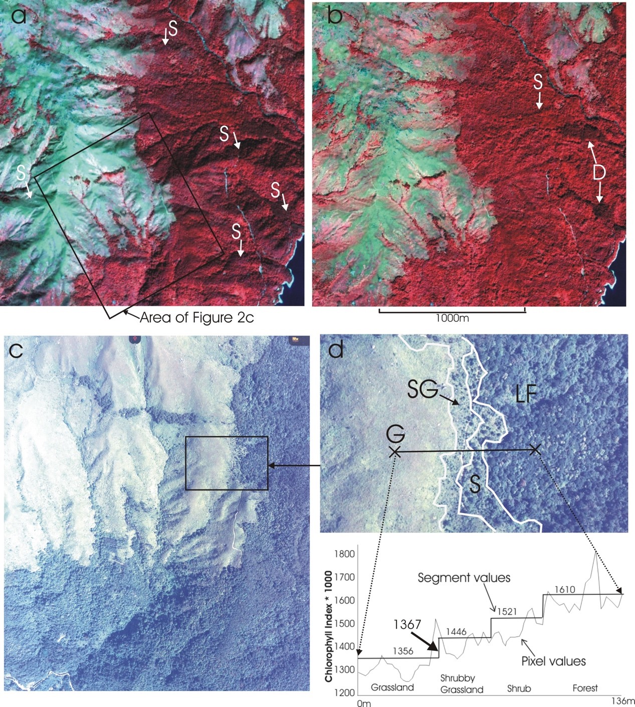 |
a. IKONOS false color, 5km² extract of study area before illumination correction, with linear contrast stretch. From bottom right to top left, a distance of ca. 3km, elevation rises from 170m to 800m. Many forested north-facing slopes (S) are in shadow.
|
Nichol J. E. and Wong M. S. (2006), Satellite remote sensing of wildlife habitats using a multi-scale, object-based, decision-tree classifier (MOOSC), WSEAS Transactions on Environmental and Development, 4(2), 353-359.
Nichol J. E. and Wong M. S. (2008), Habitat mapping in rugged terrain using multispectral IKONOS images, Photogrammetric Engineering and Remote Sensing, 74(11), 1325-1334.