• +852 2766 4655
  • rs.lab@polyu.edu.hk
  • Home
  • Projects
    • Augmented Teaching and Learning Advancement System
    • An integrated knowledge-based Remote Sensing and GIS dynamic model for the urban thermal environment
    • A UV-based Remote Sensing Technology For Sulphur Dioxide Detection And Monitoring From Ship Emissions
    • A Practical Application of Integrated Micro-Environmental Monitoring System for Construction Sites
    • Assessing the Impact of Land Use Morphology on Air Pollution and Human Mobility for COVID-19 Incidence
    • Brownfield Classification
    • Coastal Water Quality Monitoring in Hong Kong
    • Characterization of Asian Dust Storms with Geostationary satellites MTSAT
    • Development of AI-based algorithms for classification of tree species and retrieval of tree parameters using handheld laser scanning
    • Development of Hyperspectral Library to Distinguish Urban Tree Species in Hong Kong
    • Environmental adaptability of settlement
    • Estimating Time-series of Anthropogenic Heat Flux at City Scale
    • Establishment of Hong Kong AERONET Station
    • Estimation of solar irradiation on the urban building rooftop in Hong Kong
    • iBeacon Positioning
    • Identification of Rock Outcrops Using Remote Sensing Techniques
    • Impact of The Super Typhoon Manghkut on The Secondary Forest of Hong Kong
    • Jockey Club Smart City Tree Management Project
    • Land Use and Land Cover Mapping of Pearl River Delta region and Hong Kong
    • LiDAR Technique Helps to Acquire Basic Tree Information
    • Machine learning-based estimation of solar potential on three-dimensional urban envelopes
    • MOOC Course: Introduction to Urban Geo-Informatics
    • Modelling Woody Vegetation in Sudano-Sahe-lina Zone of Nigeria Using Remote Sensing
    • Remote Sensing of Forest Succession in Hong Kong's Country Parks
    • Remote Sensing of Secondary Vegetation Succession in Hong Kong's Country Parks
    • Road Defect Detection Using Deep Learning Method
    • Solar Energy Supply in Cloud-prone Areas of Hong Kong
    • Tree Thermal Image
    • 70 Years of Forest Succession in the Degraded Tropical Landscape of Hong Kong
  • People
  • Contact Us

A UV-based Remote Sensing Technology For Sulphur Dioxide Detection And Monitoring From Ship Emissions

  • You are here:
  • Home
  • UV-based RS for SO2 Dectection & Monitoring
  • Monitoring on the car

  • Data captured with different filters

  • Data Analysis

  • Photogrammetry for detecting the distance

  • SCOPE

    This project aims to develop a methodology for automated detection and monitoring of sulphur dioxide (SO2) from ship emission by using UV-based remote sensing technology.

    The Environmental Protection Department (EPD) of Hong Kong released statistics of Hong Kong air pollutant emission annually. The data shows that 50% of SO2 comes from ship emissions. To reduce such a pollution source, recently international regulations have been developed and adopted in Hong Kong, including regulations for fuel switching, improvement in fuel efficiency, and improvement in operation practices. However, the enforcement of the law becomes a challenge as the current practice of using on-board sampling from ships is not very efficient. As a result, only a very small percentage of the ships can be checked and thus there is an urgent need for an automated detection and monitoring method with remote sensing capacity. This project will develop a UV-based remote sensing technology for SO2 detection and monitoring from ship emissions.

  • METHODS

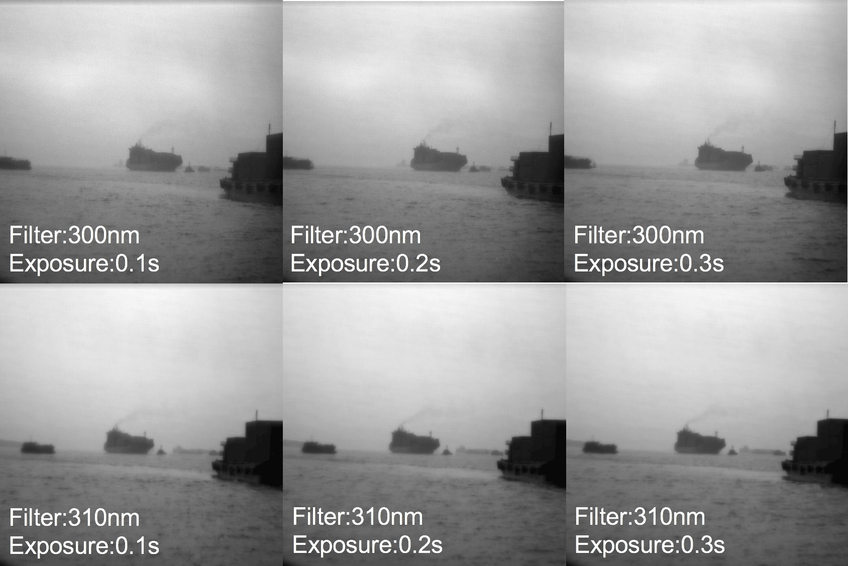
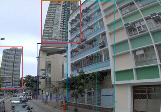
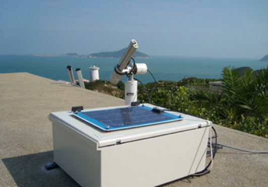
    This project utilizes a UV camera to take images of ship emissions from a distance (less than 1km) and then estimates SO2 concentrations from UV images, based on the principle that SO2 absorbs UV light. First, models between UV image intensity and SO2 concentrations in different atmospheric environments were established through systematic experiments with a specially tailor-made device; then, refined at coastal environments; and finally, calibrated with on-board samples from ships. Comparison with on-board samples from 15 ships reveals an overall accuracy of 93.33%.

  • OUTCOMES

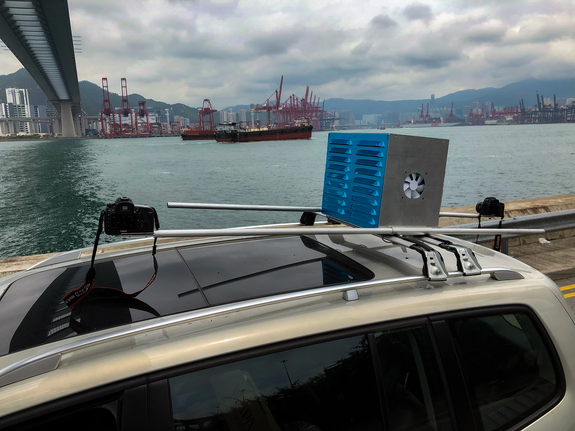
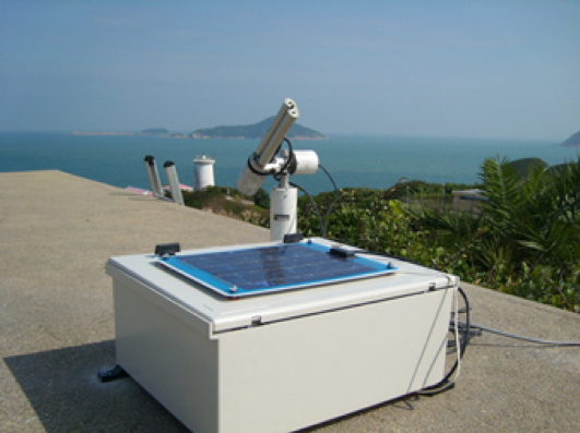
    A UV-based remote sensing technology for SO2 detection and monitoring from ship emissions has been developed. The results of experimental tests indicate that the accuracy of this technology is high. Moreover, we designed and made a platform to integrate all the components together. This planform can be mounted on both the tripod and the vehicle. In addition, a software has been developed to control the devices.

    This technology has the merits of non-contact, a high accuracy, and a capacity of monitoring more than one ships at once. In particular, it is able to quickly pinpoint the ship that emit excessive SO2.

A UV-based Remote Sensing Technology For Sulphur Dioxide Detection And Monitoring From Ship Emissions

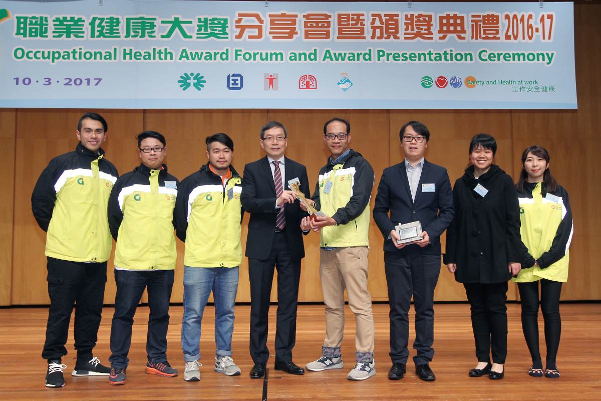
Sulfur dioxide (SO2) is a toxic gas affecting human health. In Hong Kong, 50% of SO2 comes from ship emissions, according to EPD. The Government has now adopted international regulations requiring ships to minimize SO2 emissions. However, current monitoring practice of using on-board sampling from ships is not very efficient so that only a very small percentage of ships can be checked daily. Thus, there is a need of automated methodology for inspection and/or monitoring of SO2 emissions from ships. This project serves for such a purpose. It is led by Prof. Zhilin Li, Dr. Charles Wong and Prof. John Liu.
This project aims to develop a UV-based remote sensing technology for such monitoring. It utilizes a UV (Ultraviolet) camera to take images of ship emissions from a distance (less than 1km) and then estimates SO2 concentrations from UV images, based on the principle that SO2 absorbs UV light. In this project, first of all, models between UV image intensity and SO2 concentrations in different atmospheric environments were established through systematic experiments with a specially tailor-made device; then, refined at coastal environments; and finally, calibrated with on-board samples from ships. Comparison with on-board samples from 15 ships reveals an overall accuracy of 93.33%.
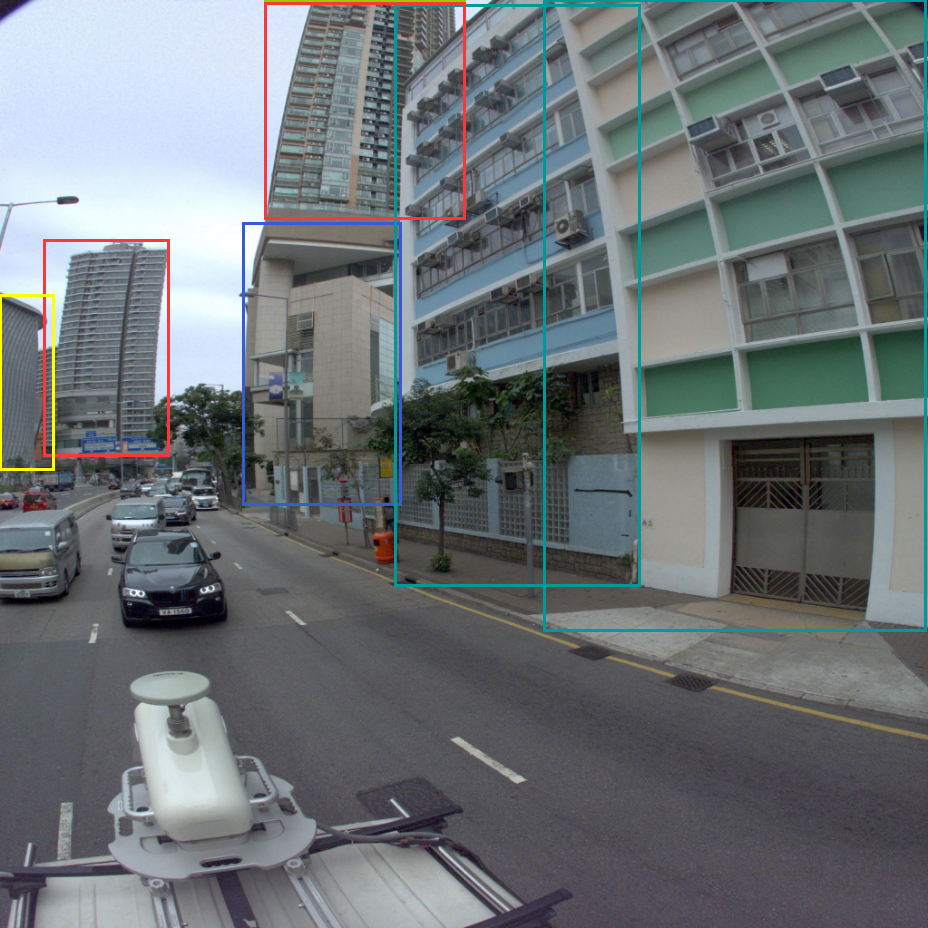
The UV camera is portable. However, a more professional system has been implemented, which comprise with one UV camera, two RGB cameras and a notebook into an expandable support device that can be mounted on tripods, cars, aircrafts and ships. The system is able to monitor multiple ships simultaneously and results can be generated at near real time.

Other Research Projects

  • Augmented Teaching and Learning Advancement System
     
    Jockey Club Smart City Tree Management Project
     
    Identification of Rock Outcrops Using Remote Sensing Techniques
    Remote Sensing of Secondary Vegetation Succession in Hong Kong's Country Parks
  • Estimating Time-series of Anthropogenic Heat Flux at City Scale
    Characterization of Asian Dust Storms with Geostationary Satellites MTSAT
    iBeacon Positioning
     
     
    Land Use and Land Cover Mapping of Pearl River Delta region and Hong Kong
  • MOOC course: Introduction to Urban Geo-Informatics
     
     
    Machine learning-based estimation of solar potential on three-dimensional urban envelopes
    Coastal Water Quality Monitoring in Hong Kong
     
     
    A Practical Application of Integrated Micro-Environmental Monitoring System for Construction Sites
  • 70 Years of Forest Succession in the Degraded Tropical Landscape of Hong Kong
    Impact of The Super Typhoon Manghkut on The Secondary Forest of Hong Kong
    Development of Hyperspectral Library to Distinguish Urban Tree Species in Hong Kong
    Remote Sensing of Forest Succession in Hong Kong's Country Parks
  • Modelling Woody Vegetation in Sudano-Sahe-lina Zone of Nigeria Using Remote Sensing
    LiDAR Technique Helps to Acquire Basic Tree Information
     
    Road Defect Detection Using Deep Learning Method
     
    Tree Thermal Image
     
     
  • Solar Energy Supply in Cloud-prone Areas of Hong Kong
     
     
    Brownfield Classification
     
    Establishment of Hong Kong AERONET Station
     
    Environmental adaptability of settlement
     
  • Assessing the Impact of Land Use Morphology on Air Pollution and Human Mobility for COVID-19 Incidence
     
    Development of AI-based algorithms for classification of tree species and retrieval of tree parameters using handheld laser scanning

     Estimation of solar irradiation on the urban building rooftop in Hong Kong
     
     
    An integrated knowledge-based Remote Sensing and GIS dynamic model for the urban thermal environment
     
  • Prev
  • Next

Copyright © 2018 - 2022.Remote Sensing Laboratory, The Hong Kong Polytechnic University. All rights reserved.

  •